Understanding Volcanic Hazards: The Science of Risk
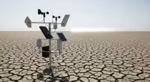
Volcanoes are complex systems, and their eruptions can unleash a variety of distinct and dangerous phenomena. Understanding these specific hazards is crucial for effective risk assessment and public safety planning. Scientists at volcano observatories across the country use a network of sophisticated instruments to detect the subtle signs of volcanic unrest, providing the foundation for early warning systems.
One of the most dangerous volcanic hazards is a pyroclastic flow. This is a fast-moving, ground-hugging avalanche of superheated gas, ash, and volcanic rock fragments, known as tephra. These flows can travel at speeds exceeding 100 miles per hour and reach temperatures of over 1,000 degrees Fahrenheit, incinerating everything in their path. They are impossible to outrun and are a primary cause of fatalities during explosive eruptions.
Another significant threat, particularly from snow- and ice-capped volcanoes, is a lahar. A lahar is a volcanic mudflow with the consistency of wet concrete. It forms when hot volcanic material rapidly melts snow and ice or when heavy rainfall mobilizes loose volcanic debris on a volcano’s slopes. Lahars can travel for tens of miles down river valleys at high speeds, burying entire communities, destroying bridges, and fundamentally reshaping the landscape.
Ashfall, or tephra fallout, can have far-reaching consequences. While not as immediately destructive as a pyroclastic flow, volcanic ash is composed of fine, abrasive particles of rock and glass. It can blanket vast areas, collapsing roofs under its weight, contaminating water supplies, and causing respiratory problems. Ash is particularly dangerous for aviation; it can be ingested by jet engines, causing them to stall and fail. This has led to the development of a global system to track ash clouds and reroute air traffic.
Other hazards include lava flows, which are streams of molten rock. While typically slow-moving enough for people to evacuate, they are unstoppable and destroy all infrastructure they encounter. Volcanoes also release gases like sulfur dioxide and carbon dioxide, which can be harmful to human health, agriculture, and the environment.
To monitor these threats, the USGS employs a range of technologies. Seismometers detect small earthquakes caused by magma moving beneath the surface. GPS stations and tiltmeters measure ground deformation, indicating that a volcano is swelling with magma. Gas sensors analyze the types and amounts of gases being released, which can signal changes in the magmatic system. This data feeds into the official Volcano Alert-Level System, a four-tiered scale (NORMAL, ADVISORY, WATCH, WARNING) that communicates the current status of a volcano to emergency managers and the public. A parallel Aviation Color Code system (GREEN, YELLOW, ORANGE, RED) informs the aviation industry of potential ash hazards, forming a cornerstone of modern volcanic risk reduction.