Causes & Mechanisms
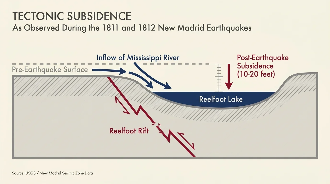
To grasp how disasters build landmarks, you must understand the underlying hazard sciences. Geologists categorize these specific landmark-creating events into three primary domains: tectonic subsidence, volcanology, and mass wasting. Tectonic subsidence occurs when intense seismic activity alters the elevation of the bedrock. During the 1811 and 1812 New Madrid earthquakes, the violent shifting of the Reelfoot Rift deep underground caused sections of the Tennessee landscape to drop anywhere from ten to twenty feet. The local fluvial system—specifically the Mississippi River—immediately rushed in to fill this new depression. River waters temporarily flowed backward, transforming a dense cypress forest into the permanent aquatic ecosystem of Reelfoot Lake.
Seismic events also trigger a phenomenon known as soil liquefaction, where saturated soils lose their structural integrity and temporarily behave like a liquid. When you study the 1964 Great Alaskan Earthquake, you see liquefaction in its most devastating form. The magnitude 9.2 earthquake shook Anchorage so violently that a subterranean layer of sensitive Bootlegger Cove clay completely failed. This failure caused massive blocks of earth to slide horizontally toward the ocean. The resulting slumping and fissuring created the jagged, uneven terrain of Earthquake Park, effectively freezing the chaotic energy of the earthquake into the landscape.
Volcanic mechanisms operate with entirely different physical processes. When magma abruptly hits groundwater or surface water, it triggers a phreatomagmatic eruption—a violent steam explosion. The 1886 Mount Tarawera eruption utilized this exact mechanism, blasting a series of deep craters across a seventeen-kilometer line and carving out the Waimangu Volcanic Rift Valley. Similarly, Japan’s Mount Bandai experienced a phreatic explosion in 1888. The extreme internal steam pressure blew away the side of the mountain, launching a debris avalanche that reshaped the watershed below and trapped water to form the Goshikinuma Lakes. You can observe another volcanic mechanism, caldera collapse, at Mount Pinatubo. When Pinatubo expelled cubic miles of magma in 1991, the summit lost its underlying structural support and collapsed inward. Monsoon rains then accumulated in this massive depression over several years, naturally generating Lake Pinatubo.
The most frequent creator of sudden lakes is mass wasting, specifically massive landslides triggered by heavy precipitation or earthquakes. Landslide-dammed lakes form when millions of tons of rock and soil slide down a mountain and completely block a river valley. At Quake Lake in Montana, the magnitude 7.2 earthquake in 1959 sheared off a massive section of a mountain, dropping 80 million tons of rock into the Madison River canyon at 100 miles per hour. A similar mechanism occurred in Wyoming during the 1925 Gros Ventre landslide, where heavy snowmelt lubricated a sloped layer of sedimentary rock, causing 50 million cubic yards of debris to slide and create Lower Slide Lake. In Pakistan, the 2010 Attabad landslide involved a massive slope failure that choked the Hunza River. Because rivers continuously flow, the water simply backs up behind these massive, unengineered debris dams, rapidly flooding the valleys upstream and drowning everything in their path.