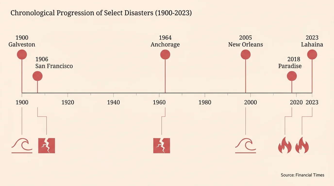
Timeline
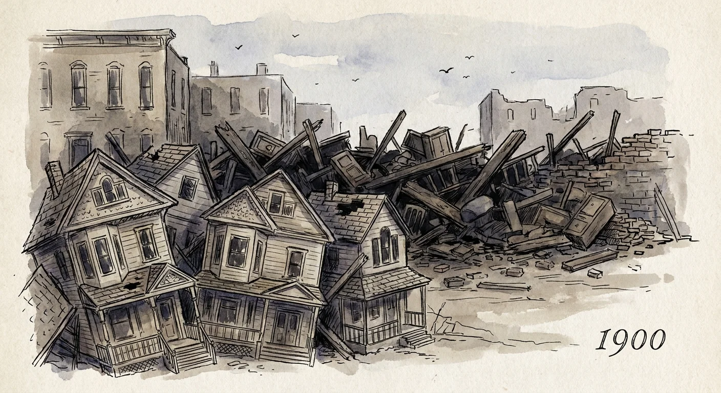
1900: Galveston, Texas
Before the turn of the century, Galveston stood as a booming commercial hub on the Gulf Coast. On September 8, 1900, an immense Category 4 hurricane struck the low-lying barrier island. Forecasters at the time possessed rudimentary tools, leaving residents with almost no advanced warning. The storm pushed a catastrophic 15-foot surge of water over an island that sat merely eight feet above sea level. This wall of ocean swept structures off their foundations, using the shattered timber as battering rams to demolish neighboring buildings. The disaster claimed over 8,000 lives, cementing its status as the deadliest natural disaster in United States history.
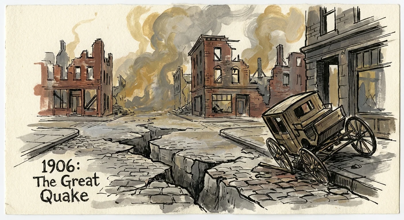
1906: San Francisco, California
San Francisco awakened to utter chaos on April 18, 1906, when the San Andreas Fault violently ruptured. The magnitude 7.9 earthquake unleashed violent shaking that lasted for nearly a minute, collapsing poorly reinforced masonry buildings and buckling the streets. However, the primary seismic impact caused only a fraction of the total devastation. The seismic waves ruptured the city’s gas lines and underground water mains simultaneously. Within hours, dozens of raging fires erupted across the city. Firefighters watched helplessly as their dry hoses proved useless against the advancing flames. The inferno raged for three days, incinerating nearly 500 city blocks.
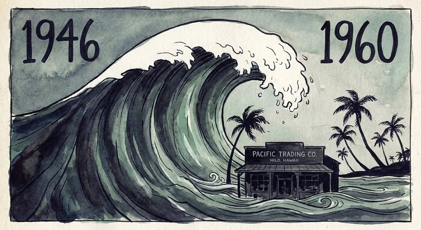
1946 and 1960: Hilo, Hawaii
The coastal city of Hilo occupies a uniquely vulnerable position on the eastern shore of the Big Island. Because Hilo Bay forms a distinct funnel shape, it drastically amplifies the height and power of incoming tsunami waves. On April 1, 1946, an earthquake in the Aleutian Islands sent massive seismic sea waves racing across the Pacific Ocean. Striking without warning, the tsunami destroyed Hilo’s waterfront and killed 159 people. Fourteen years later, the 1960 Valdivia earthquake in Chile generated another catastrophic tsunami. Despite some initial warnings, the massive waves inundated Hilo once again, heavily damaging the downtown commercial district.
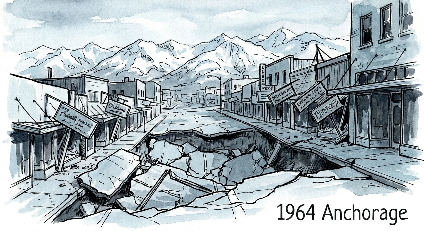
1964: Anchorage, Alaska
The Great Alaskan Earthquake struck on Good Friday, March 27, 1964. Registering a massive magnitude 9.2, it remains the most powerful recorded earthquake in North American history. The earth shook violently for nearly five agonizing minutes. Anchorage suffered catastrophic damage primarily due to massive ground failures rather than overhead structural collapse. Entire neighborhoods experienced extreme liquefaction and lateral spreading. The Turnagain Heights subdivision broke apart into massive clay blocks, sliding toward the ocean and taking 75 residential homes with it.
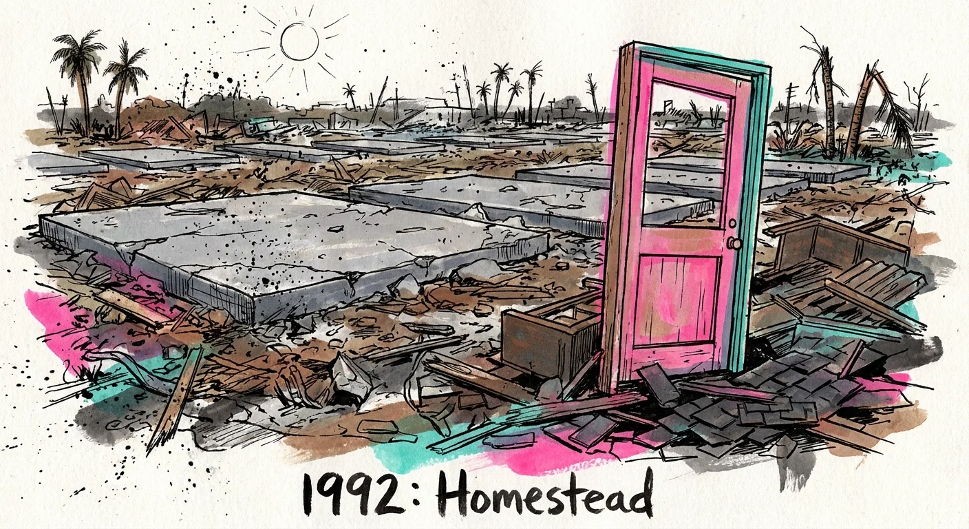
1992: Homestead, Florida
Hurricane Andrew made landfall as a catastrophic Category 5 storm on August 24, 1992, with its most intense eyewall winds scoring a direct hit on Homestead. Andrew featured an unusually compact but intensely violent wind field. Sustained winds exceeding 165 miles per hour systematically dismantled the community. The wind pressure exploited severe flaws in local building practices, lifting roofs off houses and collapsing the exterior walls. The storm entirely destroyed Homestead Air Force Base, tossing heavy fighter jets across the tarmac like discarded toys.
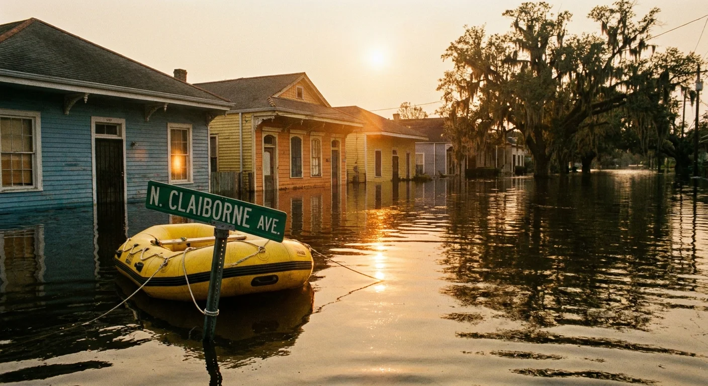
2005: New Orleans, Louisiana
Hurricane Katrina highlighted the disastrous consequences of engineering failures interacting with extreme weather. On August 29, 2005, the storm made landfall as a massive Category 3 hurricane. While the wind caused substantial regional damage, the monumental storm surge overwhelmed the complex network of levees and floodwalls protecting New Orleans. When the critical floodwalls failed, water from Lake Pontchartrain and the Gulf of Mexico poured into the bowl-shaped city. By the following day, floodwaters covered 80 percent of New Orleans, trapping thousands of residents on their roofs.
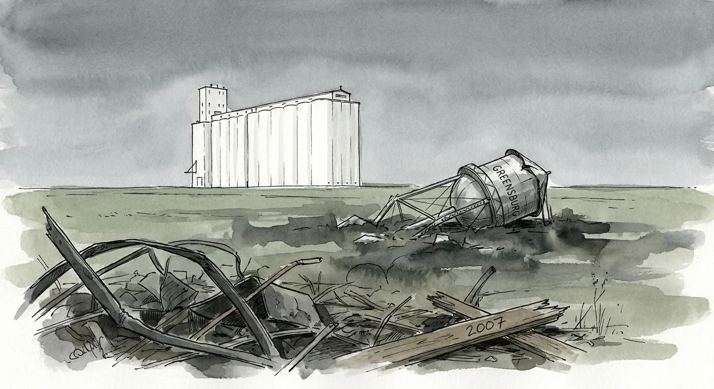
2007: Greensburg, Kansas
On the evening of May 4, 2007, an exceptionally powerful supercell thunderstorm spawned a massive tornado that took aim at the small farming community of Greensburg. The dark vortex expanded to an incredible 1.7 miles in width, effectively enveloping the entire town. Producing atmospheric winds estimated at 205 miles per hour, the EF5 tornado ground its way across the landscape for over 20 miles. It obliterated 95 percent of Greensburg’s structures, including homes, businesses, and essential municipal services, presenting the survivors with a devastatingly blank slate.
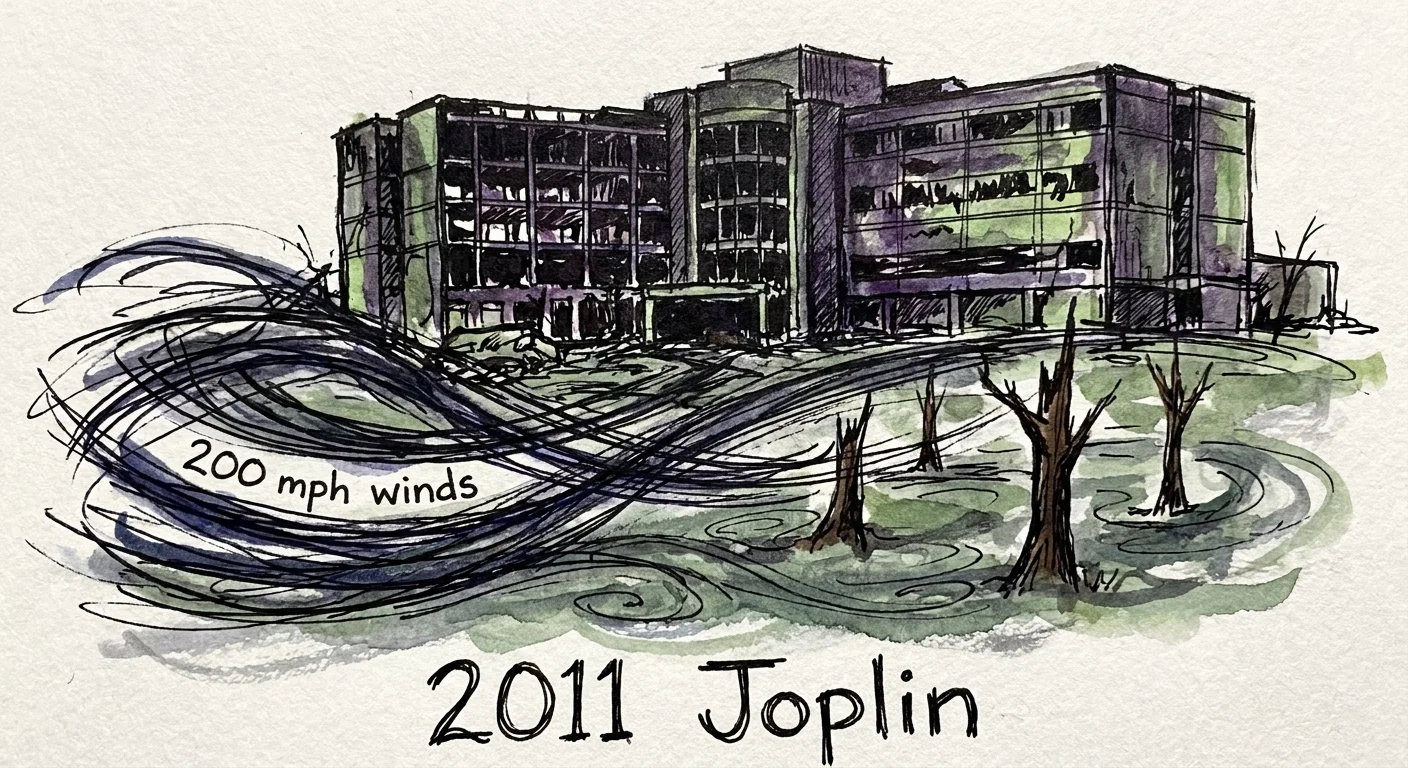
2011: Joplin, Missouri
The May 22, 2011, tornado in Joplin stands as a modern testament to the terrifying speed and extreme power of violent atmospheric events. Developing rapidly on a warm Sunday afternoon, the tornado intensified into a monstrous EF5 vortex as it tore directly through the densely populated heart of the city. The storm struck St. John’s Regional Medical Center, blowing out protective windows, shearing off the roof, and shifting the massive concrete structure entirely off its foundation. The multi-vortex tornado leveled thousands of homes and claimed 161 lives.
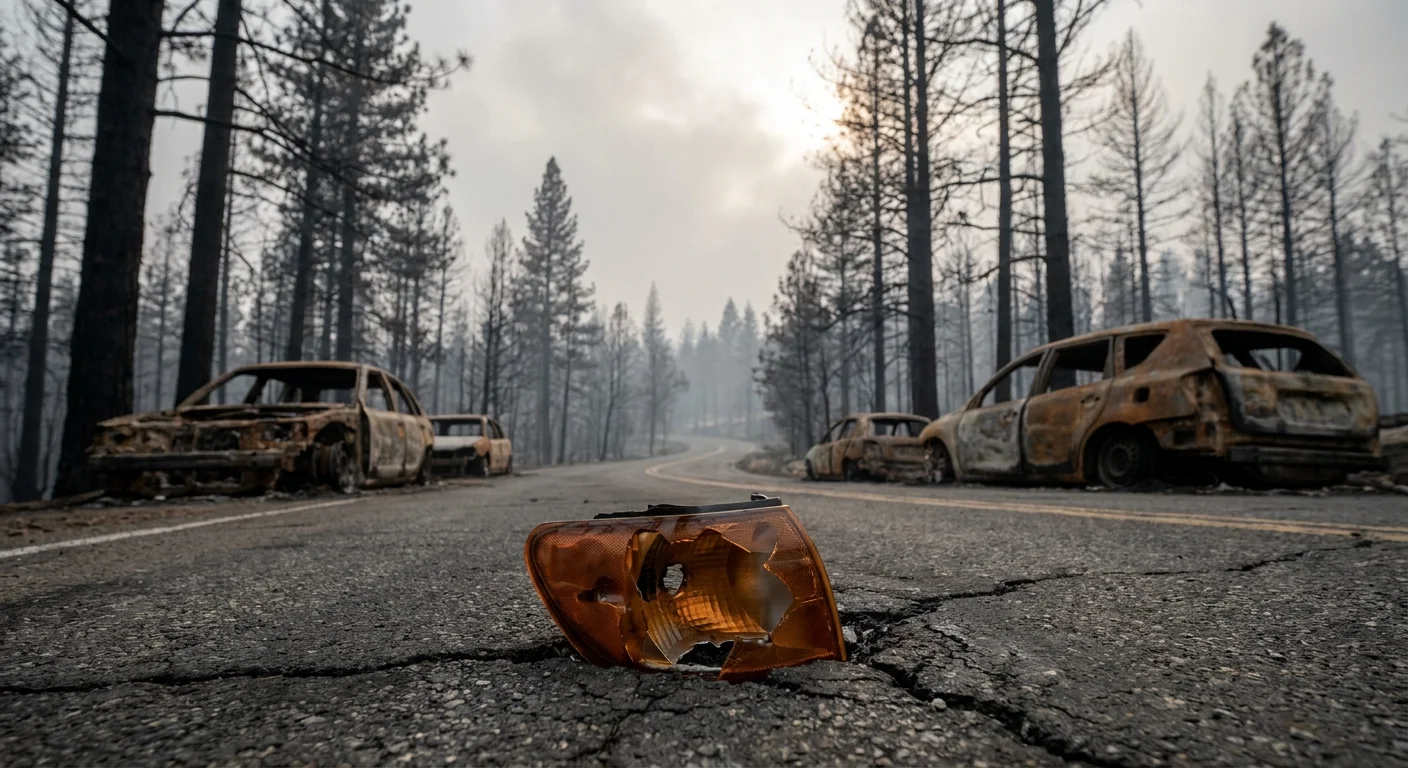
2018: Paradise, California
Nestled deep within the Sierra Nevada foothills, the town of Paradise represented a classic wildland-urban interface community. On November 8, 2018, a faulty electrical transmission line ignited dry brush in the nearby canyon. Fanned by extreme downslope winds, the Camp Fire exploded in size, advancing toward the town at an astonishing rate. A relentless blizzard of burning embers leaped ahead of the main fire front, igniting buildings and trapping residents on choked, narrow evacuation routes. The inferno destroyed over 18,000 structures, essentially erasing the town from the map.
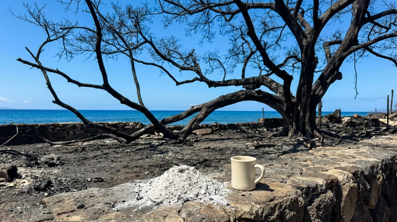
2023: Lahaina, Hawaii
The historic coastal town of Lahaina faced an unimaginable tragedy on August 8, 2023. A deadly combination of severe drought, invasive dry grasses, and powerful winds from a distant Pacific hurricane created extreme fire weather conditions. A brush fire quickly breached containment lines, sending a firestorm directly into the densely packed wooden structures of the historic district. The blaze moved with staggering speed, forcing desperate residents to flee into the ocean to escape the blistering radiant heat. The fire reduced centuries of history to toxic ash within mere hours.