Understanding the ten American floods that permanently altered state geographies and policies provides you with actionable insights into modern disaster preparedness. From the sudden dam failure that decimated Johnstown, Pennsylvania, to the sprawling inundation of Hurricane Harvey across Texas, historic flood disasters showcase the sheer force of water against vulnerable infrastructure. These ten landmark events reshaped federal emergency management, dictated new engineering standards, and redefined how communities respond to catastrophic weather history. By examining the mechanisms, timelines, and cascading impacts of these unparalleled natural disasters, you will recognize the critical vulnerabilities in your own region and learn how evolving flood control measures strive to protect lives and property today.
Overview
The history of the United States is intrinsically tied to the waterways that allowed early cities to flourish. However, the reliance on rivers and coastlines introduced monumental risks. This article covers ten definitive American floods that changed entire states forever. These catastrophic events include the 1889 Johnstown Flood in Pennsylvania, the 1900 Great Galveston Hurricane and Flood in Texas, the 1927 Great Mississippi Flood, the 1937 Ohio River Flood, the 1948 Vanport Flood in Oregon, the 1972 Rapid City Flood in South Dakota, the 1976 Big Thompson Canyon Flood in Colorado, the Great Flood of 1993 in the Midwest, the 2005 Hurricane Katrina storm surge in Louisiana and Mississippi, and the 2017 Hurricane Harvey floods in Texas. Each of these disasters serves as a profound benchmark in weather history, demonstrating the raw, destructive capability of unchecked water.
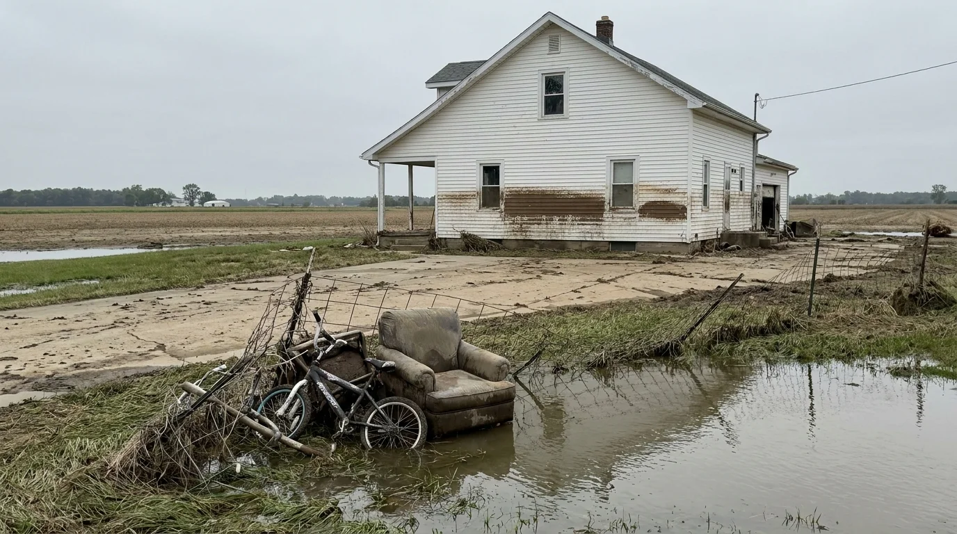
You might assume that a flood simply involves water rising over its banks and retreating shortly after. In reality, historic floods function as massive geographic and social resets. When these ten disasters struck, they did not just ruin buildings; they permanently relocated populations, destroyed regional economies, and forced state governments to rewrite their fundamental laws regarding land use and infrastructure. For instance, the 1927 Great Mississippi Flood displaced hundreds of thousands of residents and accelerated a demographic shift across the nation known as the Great Migration. Decades later, the 1948 Vanport Flood completely erased Oregon’s second-largest city from the map in a single afternoon, permanently changing the demographic distribution of the Pacific Northwest.
The core takeaway from studying these ten disasters is that engineering alone cannot eliminate natural hazards; human resilience requires a combination of robust infrastructure, accurate early warning systems, and comprehensive evacuation planning. The scope of these events ranges from localized, high-velocity flash floods in narrow mountain canyons to slow-moving, massive regional inundations that swallow millions of acres of farmland for months at a time. State borders, local economies, and individual lives were irreversibly altered by the force of moving water.
As you analyze these events, you will notice distinct patterns in how both local and federal authorities reacted. In the late nineteenth and early twentieth centuries, disaster response was largely a private, charitable endeavor. By the turn of the twenty-first century, managing flood disasters evolved into a highly coordinated, albeit deeply complex, multi-agency operation. Learning about these pivotal shifts helps you contextualize modern flood risks and underscores the importance of taking personal and community-wide precautions before the next historic storm arrives.