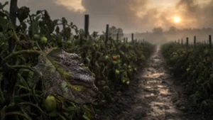
Timeline
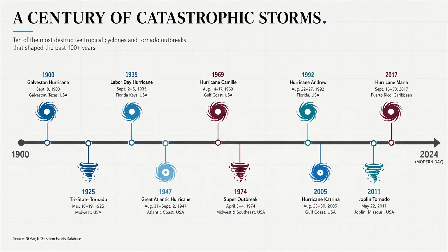
The twentieth century opened with a catastrophic wake-up call when the Great Galveston Hurricane struck the Texas coast on September 8, 1900. Without modern satellite warnings or radar, the residents of the thriving island city had almost no time to prepare. The Category 4 hurricane pushed a massive storm surge across the low-lying barrier island, completely submerging the city. In a matter of hours, the storm leveled thousands of buildings and forever altered the trajectory of coastal development in the United States.
A quarter of a century later, a completely different type of atmospheric monster tore across the American Midwest. On March 18, 1925, the Tri-State Tornado touched down in Missouri and carved a continuous path of destruction across Illinois and Indiana. The tornado stayed on the ground for an unprecedented 219 miles, advancing at forward speeds exceeding 60 miles per hour. Entire mining towns splintered into debris before residents even realized a tornado approached, marking the deadliest tornadic event in the history of the region.
As populations grew in highly vulnerable coastal regions globally, the potential for mass-casualty events increased. On November 12, 1970, the Bhola Cyclone made landfall in the densely populated Ganges Delta region of East Pakistan, which later became Bangladesh. The cyclone arrived during a high lunar tide, maximizing the height of the storm surge. The water swept across the flat, unprotected islands of the delta, wiping out entire farming communities overnight and initiating a cascade of political shifts in South Asia.
Five years later, the world witnessed how extreme weather could trigger catastrophic infrastructure failures. In August 1975, Super Typhoon Nina stalled over the Henan province of China. The decaying typhoon unleashed historically unprecedented rainfall, dropping more than a year’s worth of precipitation in a single day. The deluge overwhelmed the Banqiao Dam and dozens of smaller cascading reservoirs. The resulting inland tsunami erased entire downstream cities, demonstrating the severe limitations of mid-century hydrological engineering.
The modern era of storm disasters forced the global public to watch systemic failures unfold on live television. On August 29, 2005, Hurricane Katrina made landfall along the United States Gulf Coast. While the storm ravaged Mississippi with unparalleled storm surge, the most shocking devastation occurred in New Orleans. The storm exposed critical weaknesses in the federal levee system. When the floodwalls breached, water engulfed eighty percent of the city, stranding thousands on their roofs and triggering a massive, chaotic domestic rescue operation.
Three years later, the international community struggled to respond when Cyclone Nargis struck Myanmar on May 2, 2008. The cyclone sent a massive surge up the Irrawaddy Delta, devastating coastal villages. The situation rapidly deteriorated due to initial political resistance to international aid. Humanitarian agencies waited for days at the borders while survivors lacked clean water, medical supplies, and basic shelter, turning an acute weather disaster into a prolonged humanitarian crisis.
As global ocean temperatures continued to rise, meteorologists observed storms achieving frightening new maximum intensities. On November 8, 2013, Super Typhoon Haiyan slammed into the Philippines. Haiyan featured some of the highest sustained wind speeds ever recorded at landfall, approaching 195 miles per hour. The typhoon acted like a giant coastal blender, pushing a sudden, tsunami-like storm surge into the city of Tacloban and testing the absolute limits of international disaster response logistics.
The year 2017 brought a barrage of historic storms that tested the resilience of the Americas. In late August 2017, Hurricane Harvey stalled over Texas. Instead of moving inland and dissipating, Harvey sat over the Houston metropolitan area for days, dumping an unfathomable 60 inches of rain in some locations. The storm overwhelmed local bayous, reservoirs, and drainage systems, proving that slow-moving rainfall events can cause as much economic devastation as high-wind hurricanes.
Less than a month later, on September 20, 2017, Hurricane Maria devastated Puerto Rico. The Category 4 hurricane essentially buzz-sawed across the entire island. The intense winds and resulting landslides obliterated the island’s fragile power grid and communication networks. The storm plunged communities into darkness for months, creating a prolonged public health disaster where lack of access to refrigeration, clean water, and medical care caused secondary fatalities long after the skies cleared.
Rounding out this historical analysis is Cyclone Idai, which struck the southeastern coast of Africa in March 2019. Idai made landfall near the port city of Beira in Mozambique before stalling inland. The storm dumped torrential rains across Mozambique, Zimbabwe, and Malawi, creating an inland ocean that submerged entire rural communities. The flooding destroyed the region’s agricultural yield right before the harvest season, plunging millions into extreme food insecurity and emphasizing the profound threat of severe weather in developing nations.