Extreme natural forces destroy everything in their path, but they also serve as the earth’s ultimate architects, carving out breathtaking new landmarks from the wreckage of catastrophe. Examining the geological aftermath of monumental seismic shifts, volcanic explosions, and catastrophic landslides reveals profound geographical transformations that redefine entire regions. Violent upheavals give birth to vibrant lakes, deep calderas, and sprawling rift valleys that eventually attract thousands of visitors. By understanding the immense energy released during these events, you gain a deeper appreciation for the volatile planet we inhabit. Exploring the origins of these nine specific geological anomalies reveals how intense devastation lays the groundwork for natural beauty, permanently altering maps and reshaping the environment for future generations.
Overview
Our planet constantly redraws its own boundaries through sudden, violent energy releases. When you look at a map, you might assume that lakes, valleys, and mountains have existed since the dawn of time. However, many prominent geographical features emerged overnight as the direct result of catastrophic natural disasters. Exploring nine specific locations allows you to witness the raw power of earth sciences in action, demonstrating how quickly the environment adapts to total devastation.
In the United States, the earth shaped several iconic landmarks through extreme force. The 1811 and 1812 New Madrid earthquakes caused the Mississippi River valley to violently subside, creating Reelfoot Lake in Tennessee. Decades later, the massive 1925 Gros Ventre landslide in Wyoming dammed a river to birth Lower Slide Lake. The violent 1959 Hebgen Lake earthquake in Montana triggered another colossal mountain collapse, permanently forming Quake Lake. In 1964, the Great Alaskan Earthquake liquefied the ground beneath Anchorage, causing coastal bluffs to slide into the ocean and leaving behind the chaotic terrain now known as Earthquake Park. Finally, the explosive 1980 eruption of Mount St. Helens in Washington State decapitated a mountain, leaving a spectacular horseshoe-shaped crater and forming the dramatic Loowit Falls from the ensuing glacier melt.
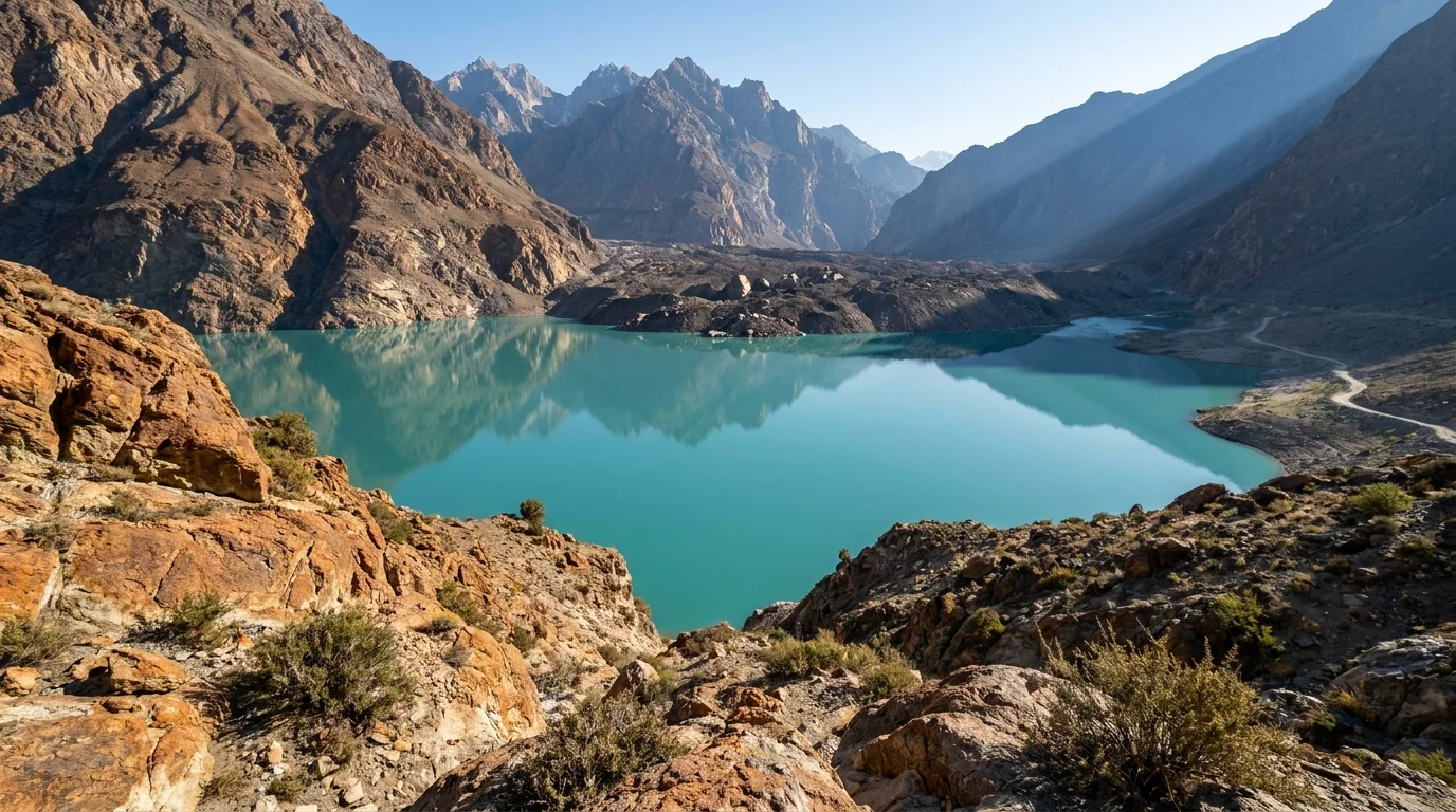
Across the globe, similar cataclysms forced local populations to navigate entirely new environments. The 1886 eruption of Mount Tarawera in New Zealand destroyed the legendary Pink and White Terraces but violently ripped open the earth to create the Waimangu Volcanic Rift Valley. In Japan, the 1888 collapse of Mount Bandai unleashed a massive debris avalanche that blocked local rivers, eventually forming the vividly colored Goshikinuma Lakes. The 1991 climax of the Mount Pinatubo eruption in the Philippines triggered a caldera collapse that slowly filled with monsoon rains to become Lake Pinatubo. More recently, a massive 2010 landslide in Pakistan buried the Hunza Valley, obstructing a major river and creating the expansive Attabad Lake.
These nine locations share a common history of destruction and rebirth. Studying them provides practical insights into how natural hazard systems operate and how communities eventually recover. By understanding the origins of these accidental landmarks, you learn to recognize the ongoing geological processes that continue to threaten and shape human settlements today.