Volcanic ash in volume greater than the sum of all other volcanic eruptions in Alaska was ejected and devastated every place within miles of the eruption.
The largest twentieth century eruption anywhere on Earth occurred in Alaska, on June 6, 1912, creating the Katmai Caldera and the Valley of Ten Thousand Smokes. Volcanic ash, in quantities more than from all other historical eruptions in Alaska combined, devastated areas hundreds of miles away. An ominous cloud rose into the sky above Mount Katmai, reached an altitude of twenty miles, and within four hours’ ash from this huge volcanic eruption began to fall on the village of Kodiak, one hundred miles to the southeast.
By the end of the eruption, the ash cloud, measuring thousands of miles across, shrouded southern Alaska and western Canada, and sulfurous ash was falling on Vancouver, British Columbia, and Seattle, Washington. On June 7, the cloud passed over Virginia and by June 17, it had reached Algeria in Africa.
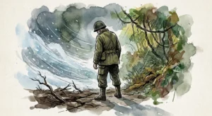
During the three days of the eruption, darkness and suffocating conditions caused by falling ash and sulfur dioxide gas immobilized the population of Kodiak. Sore eyes and respiratory distress were rampant, and water became undrinkable. Radio communications were totally disrupted and, with visibility near zero, ships were unable to dock. Roofs in Kodiak collapsed under the weight of more than a foot of ash, buildings were overwhelmed with ash, and many structures were burned.
Novarupta, meaning “new eruption,” is a volcano that sits below Mount Katmai and that shared in the eruption, an event that was ten times more powerful than the 1980 eruption of Mount St. Helens. More than three cubic miles of volcanic material was ejected over two and a half days. The 1815 eruption of Tambora, by comparison, displaced about seven times as much material. The 1883 eruption of Indonesia’s Krakatoa displaced twice as much. Magma from underneath Mount Katmai area was drained away, leaving a collapsed caldera that measured four square miles in surface area.
Several villages were abandoned forever and much animal and plant life had been decimated by ash and acid rain. Bears and other large animals were blinded by ash and starved when large numbers of the plants and small animals they lived on were wiped out. Millions of dead birds that had been blinded and coated by volcanic ash littered the ground. Aquatic organisms, such as mussels, insect larvae, and kelp, as well as the fish that fed upon them, perished in ash-choked shallow water. Alaska’s salmon-fishing industry was devastated, especially from 1915 to 1919, because of the failure of many adult fish to spawn.
Augustine is a good example of the frequency of volcanic eruptions in and around Cook Inlet, but Mount Katmai, a 6,000 foot peak, is an example of quite a different kind: as the world’s largest twentieth century eruption it is certainly Alaska’s worst ever within historic times. Mount Katmai and its sister mountain, Novarupta, are about ninety-five miles southwest of Augustine and three hundred miles southwest of Anchorage, within what is now known as Katmai National Park and Preserve. When the eruption happened, after centuries of silence from both of these mountains, more than three cubic miles of ash and small particles were blown into the sky, giving rise to a new name for the area—“Valley of Ten Thousand Smokes.” Villagers from Katmai and other nearby communities moved away to a safer location.
The Katmai area was permanently changed by the eruption. Enormous quantities of hot, glowing pumice and ash flowed over the terrain, destroying all life in its path. Trees up slope were snapped off and carbonized by the blasts of hot wind and gas. For several days after the explosion ash, pumice, and gas created a haze that darkened the sky over most of the Northern Hemisphere. When it was over, more than forty square miles of lush green land lay buried beneath volcanic deposits as deep as seven hundred feet deep. For two full days, people in nearby Kodiak could not see a lantern held at arm’s length.
Acid rain caused clothes to disintegrate on clotheslines as far away as Vancouver, Canada. In the valleys of Knife Creek and the Ukak River, innumerable small holes and cracks developed in the ash deposits, permitting gas and steam from the heated groundwater to escape. A ship moored in Kodiak harbor at the time of the eruption gave this account of events. Five inches of ash fell everywhere, choking all wells and streams on shore. Visibility dropped to fifty feet and after about two more hours, at a time when the sun would have been shining brightly, pitch darkness set in and continued into the morning of the next day. Decks, masts, and lifeboats were all covered with a fine, yellowish colored dust.
Avalanches of ashes could be heard sliding down the neighboring hills and sending out clouds of suffocating dust. The crew on ships kept working continually with shovels and hoses to try to get rid of the ash. The amount on the ground of Kodiak averaged one foot in height. Like other gigantic events of this kind, where ash and other materials are flung high into the upper atmosphere, the effects of Katmai’s eruptions were felt far and near. There were over 40,000 square miles of the surrounding area covered with ash to an average depth of two inches. Smaller amounts of ash fell on Juneau, more than seven hundred miles to the southeast and still less on Seattle, about 1,500 miles to the south. Some ash particles reached far enough into the atmosphere that they were caught in global circulation patterns and provided spectacular red sunsets for months. In terms of the original volume of molten rock released, comparisons can be made with other major events. On this basis, there were three cubic miles of magma ejected from Katmai, thirty times greater than the volume of magma released in the 1980 eruption of Mount St. Helens. Even the 1991 eruption of Mount Pinatubo, the second largest of the twentieth century, was less than half the size of Katmai’s.
In 1916, a National Geographic Society expedition led by Robert Griggs visited Mount Katmai and found a two-mile-wide crater where its summit had been before 1912. Nearby, the expedition discovered a newly formed lava dome they called “Novarupta” and huge flows of volcanic ash filling what they named the “Valley of Ten Thousand Smokes” for the numerous plumes of steam rising from the still-hot ground. Griggs’ descriptions of these spectacular features helped persuade President Woodrow Wilson to create Katmai National Monument (now Katmai National Park) in 1918.
In the 1950’s, volcanologists discovered that the great Alaskan eruption of 1912 was not really from Mount Katmai, as previously thought, but from a new vent at Novarupta. The eruption removed so much molten rock (magma) from beneath Mount Katmai, however, that a cubic mile of Katmai’s summit collapsed to form a two-mile-wide volcanic depression, a caldera, now a lake eight hundred feet deep. Despite the fact that the eruption was so close to the Continental United States and comparable in magnitude to that of Krakatau of 1883, it was hardly known at the time because the area was so remote from the world’s main population centers.
Almost a hundred years after it happened, researchers are paying attention to Katmai because it is near the Arctic Circle and its impact on climate appears to be quite different from that of volcanoes in lower latitudes. When a volcano erupts anywhere, it does more than spew clouds of ash locally and shadow a region from sunlight so that it cools for a few days; it also blows sulfur dioxide, a gas irritating to the lungs and smelling like rotten eggs. If the eruption is strongly vertical, it shoots that sulfur dioxide high into the stratosphere as far as ten miles above the Earth. In the stratosphere, sulfur dioxide reacts with water vapor to form sulfate aerosols.
Because these aerosols float above the altitude of rain, they don’t get washed out, they linger, reflecting sunlight and cooling Earth’s surface. A condition of this kind can create a kind of nuclear winter for a year or more after an eruption. In April 1815, for instance, the Tambora volcano in Indonesia erupted. The following year, 1816, was called “the year without a summer,” with snow falling across the United States in July. Even the smaller, June 1991, eruption of Pinatubo in the Philippines cooled the average temperature of the northern hemisphere summer of 1992 to well below average. However, both of these eruptions, as well as Krakatau, were tropical events. Katmai and Novarupta are just south of the Arctic Circle.
Using a NASA computer model at the Goddard Institute for Space Studies (GISS), Professor Alan Robock of Rutgers University and colleagues found that Katmai’s effects on the world’s climate would have been different. The stratosphere’s average circulation is from the equator to the poles, so aerosols from tropical volcanoes tend to spread across all latitudes both north and south of the Equator, quickly circulating to all parts of the globe. Aerosols from an arctic eruption tend to stay north of 30°N; that is, no further south than the Continental United States or Europe.
These aerosols would mix with the rest of Earth’s atmosphere only very slowly. This bottling up of arctic aerosols in the north would make itself felt, according to the findings of GISS, in India. According to the computer model, the Katmai blast would have weakened India’s summer monsoon, producing an abnormally warm and dry summer over northern India. Why India? Cooling of the northern hemisphere by Katmai would set in motion a chain of events involving land and sea surface temperatures, the flow of air over the Himalayan mountains and, finally, clouds and rain over India. This is an unusual and rather complicated conclusion from Robock’s research and it only became clear when the supercomputers were employed in the calculations.
To check the results of his study, Robock and colleagues are examining weather and river flow data from Asia, India, and Africa in 1913, the year after Katmai. They are also investigating the consequences of other highlatitude eruptions in the last few centuries. The fact that the stratosphere in high latitudes is shallower than at the tropics means that even small eruptions near the North Pole may deposit more aerosols than bigger events in the tropics. Furthermore, they would remain in circulation longer as happened with Katmai.
Indians will need to keep an eye on Arctic eruptions. There is yet another consideration: even years after an eruption, volcanic ash deposited within two hundred miles of the eruption site would be remobilized by windstorms and blown high into the atmosphere, renewing the hazards for people and machinery. Fish and wildlife would be devastated as they were after the 1912 eruption, wreaking prolonged havoc on Alaska’s now large and economically important fishing and tourism industries.
The chance of another Katmai-scale eruption occurring in any given year is small, but such cataclysmic volcanic events are certain to happen again in Alaska. Within five hundred miles of Anchorage, volcanologists have identified at least seven deposits of volcanic ash younger than 4,000 years that approach or exceed the volume of ash ejected by Katmai in 1912, including a thick layer of ash erupted from Hayes Volcano, only ninety miles northwest of Anchorage. Of the numerous volcanoes scattered across southern Alaska, at least ten are capable of exploding in a 1912-scale eruption.


2 thoughts on “Katmai Volcanic Eruption – Alaska – June 6, 1912”
Am struck with awe as I pondered three cubic miles of ash. I am also a proponent of the Pebble mine, if it were successful to mine stage and conclusion. What are the risks into the 2060’s and 70’s that such an eruption would occur in Alaska again?
i visited a friend in anchorage in 2008 and he took us to katmai falls to watch bears catching salmon, and after that to a place called the valley of 10,000 smokes, unbelievable beautiful rock formation formed after volcanic eruption of 1912, absolutely mind blowing. alaska is full of natural beauty, returned to alaska in 2010 and 2013 never a dull moment the most beautiful place on earth.