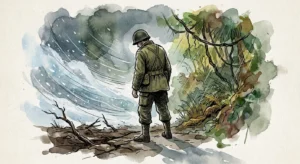
An earthquake, estimated at magnitude greater than 9, and accompanied with an equally powerful tsunami swept across the Pacific Northwest near Seattle.
On the twenty-sixth of January 1700, a massive earthquake of magnitude greater than 9 shook the ocean floor west of Seattle. It occurred about one hundred miles off shore in the zone where the Juan de Fuca Tectonic Plate subducts beneath the North America Plate. A tsunami followed quickly because the distance from the epicenter to Seattle was small. A wall of water swept over the whole coastal area, destroying everything in its path. How do we know that these things happened? The only humans who lived in this area in 1700 were native people and they had no written records or indicators of time that could tell us. The answer lay in a series of events that began in the mid-1980s.
A nuclear power plant was being installed south of Seattle in the 1980s and the nuclear regulatory authorities wanted to know if there were any seismic concerns that ought to be taken into consideration. The initial response from geologists was that there was no record of big earthquakes in this area so a nuclear power plant would not be in danger, but the question that had been asked stimulated new questions that no one had previously asked. Geologists knew that, throughout historical time, there had not been any record of an earthquake of magnitude 8 or 9 at the Juan de Fuca site, yet all along the Pacific Coast of North and South America there were earthquakes of this magnitude in all the other regions. Is the Pacific Northwest unique? Do the gigantic Pacific and North American plates behave differently here than they do everywhere else? It was the remaining portion of an older Pacific spreading ridge, namely the Juan de Fuca Plate that caused the massive 1964 earthquake in Alaska, but that same plate is subducting beneath the Pacific Northwest. Why were there no big earthquakes there? These were the questions.
By the 1980s refinements in our knowledge of plate tectonics, particularly awareness of the much greater power in plates that are subducting when the distances from their spreading ridges are short as they were with the Juan de Fuca Ridge, persuaded scientists to search for evidence of past quakes in the Northwest. Perhaps, they speculated, there were powerful earthquakes in the past of which we know nothing because this part of the country has been settled for such a short time. Digging down beside a stream close to the coast, one geologist found layers of sand and mud below the surface. They extended downward for about six feet before coming to an abrupt stop at a junction with a layer of peat. As he dug down farther he found another layer of sand and mud below the peat. It was obvious that this part of the coast had once been below high water, then above it, and then below it again before coming to its present state with topsoil in the uppermost eight inches. Furthermore, the sharp demarcation lines between peat and sand suggested that the changes from below to above water had been sudden, just the sort of thing known to be typical of subduction earthquakes.
If this was indeed the result of a former subduction earthquake there ought to be similar layers of mud and peat at the same depths all over the same place. Before long, evidence of such was found in abundance. In one place, a number of additional sets of layers were uncovered, suggesting that there might have been a succession of subduction quakes, separated by long periods of quiescence. As researchers moved farther and farther back from the coast, looking carefully at each location where layers of mud and peat were found, a very fine layer of sand on the peat seemed to become thinner and thinner the further you were from the coast. This is exactly what you would expect if a powerful tsunami had swept across the land following an earthquake. Samples of plant material and bits of wood from the top peat layer were collected and their age calculated using the carbon-14 technique. They were found to be approximately three hundred years old. At the same time, all sorts of additional data kept coming in, all confirming the original speculation that this region has always experienced massive subduction earthquakes, as many as thirteen over the past six thousand years, the last one being before there was any European settlement, about three hundred years ago.
It became clear that, in 1700, one of the world’s largest earthquakes had hit the west coast of North America. The undersea Cascadia thrust fault ruptured along a six-hundred-mile length, from mid Vancouver Island to northern California in a great earthquake, producing tremendous shaking and a huge tsunami that swept across the Pacific. The Cascadia Fault is the boundary between two of the earth’s tectonic plates: the smaller offshore Juan de Fuca Plate, formerly the Pacific Plate before the North American Plate had overtaken it, now the one that is sliding under the much larger North American Plate. This earthquake caused a shaking of the houses of the Cowichan people on Vancouver Island as we know from their stories. The shaking was so violent that people could not stand and so prolonged that it made them sick. On the west coast of Vancouver Island, the tsunami completely destroyed the winter village of the Pachena Bay people leaving no survivors. These events are recorded in the oral traditions of the First Nations people on Vancouver Island. The tsunami swept across the Pacific also causing destruction along the Pacific coast of Japan. It is the accurate descriptions of the tsunami and the accurate time keeping by the Japanese that allows us to confidently know the size and exact time of this great earthquake.
It was as geologists began to get firm data about the 1700 earthquake that they made contact with a Japanese seismologist who happened to be visiting North America and became interested in the Pacific Northwest. This seismologist was well acquainted with subduction earthquakes and the tsunamis that so often accompanied them because they were common occurrences in his home country of Japan. He concluded that if one had occurred here about three hundred years ago it ought to be possible to prove that it had happened. Japan, being an older civilization, has records of earthquakes and tsunamis going back many hundreds of years. When he returned to his country he found that a powerful tsunami, of the kind that would be triggered by an earthquake of magnitude 9 or more, had struck Honshu, Japan’s main island, exactly three hundred years ago and that it came from this part of North America. Knowing the speed of the tsunami he was able to say exactly when the earthquake took place. It was the twenty-sixth of January 1700.
A researcher from the Geological Survey of Japan, along with a team of scientists from the University of Tokyo, found Japanese records of tsunami occurrences along the country’s eastern coastline between January 27 and 28, 1700. Careful analysis of these historic tsunami records indicated that several coastal villages were damaged. Accounts were recorded in different villages along Japan’s coastline. Seawater was known to have covered land as if it had been high tide. Water went as far as the pine trees and returned to the ocean very fast. Reports indicated repeated waves of water coming in and going out as many as seven times before noon. Because the way the tide came in was so unusual, people were advised to move to higher ground. Some accounts tell of twenty houses being destroyed by waves ten feet high. Rice paddies were destroyed by these waves.
The long history of subduction activity is the key to the history of the Cascade Range of mountains that lie north and south of Seattle near the coast. These mountains are located approximately 170 miles from the coast. If we were to imagine a line descending directly downward into the earth from these mountains we would encounter the subducting ocean crust from the Juan de Fuca Plate at a depth of about seventy miles. Ocean crust from the Juan de Fuca ridges descends slowly so it has traveled some distance inland before it gets down to a depth of seventy miles. At that level the heat in the crust and in its associated water and other volatile material is high enough to create pockets of magma, which rise close to the surface. If a conduit permits any of this magma to break out on to the surface we have a volcanic eruption.
The Cascade Range is a series of stratovolcanoes; that is to say, volcanic mountains that are conical in shape because of the nature of the lava that built them over the past thousands of years. Other volcanoes, such as those in Hawaii, have a different shape because the lava that built them has a different chemical composition. The Cascades run from Mount Garibaldi north of the Canadian border all the way to Mount Lassen in northern California and each peak has its own unique history; some have a very violent past while others either took shape quietly or we do not know enough about their past. We will look briefly at some of these volcanic peaks, beginning at the south end at Mount Lassen. This mountain in northern California experienced a major eruption in 1915 with continuing action at different times over the following two years. The type of rock that erupted was mostly basalt, but in the explosive action accompanying the main event hot rocks were thrown on to its snow-covered sides, triggering major debris flows. In Lassen Volcanic National Park, which includes Mount Lassen and three smaller volcanic centers, the present-day geothermal system has a magma pool near enough to the surface to provide hot water. This system consists of a reservoir with a temperature of more than 400 degrees, underlain by a reservoir of hot water.
Crater Lake, farther to the north, in Oregon, is the remnant of a catastrophic eruption of what was once Mount Mazama, over 10,000 feet high. In that gigantic upheaval of 7,000 years ago, thousands of tons of matter were flung into the air in a pyroclastic flow that spread ash over large parts of eight states. It was an explosion that was probably ten times greater than the one that occurred later in Mount St. Helens. As often happens in an event of this magnitude, the summit of the mountain sank back into the now empty five-mile-wide inner magma chamber and went down below ground level. The empty caldera then filled with water to form the place we know as Crater Lake. Mount Baker has a summit rising to more than 9,000 feet. Apart from Mount St. Helens it is the most active volcano in Washington State. Steam and gas emissions from it were common during the 1970s. Glacier Peak is a volcanic mountain very similar to Mount Baker. Its height is more than 10,000 feet and, like Baker, its cone is less than one million years old. Mount Hood is the fourth highest peak. It has been active for more than twenty million years.
Mount Rainier is the highest mountain of the Cascades, towering more than 12,000 feet above sea level. It has the greatest concentration of glaciers of any mountain in the lower forty-eight. Like other peaks of the Cascades its growth occurred within the last million years but, within that period, all sorts of volcanic eruptions, landslides, and mudflows devastated the surrounding area. As recently as 1989 a gigantic rock avalanche crashed down on the north side of the mountain. Debris flows like this one give a great deal of concern to surrounding settlements. Glacial outburst floods originate when water stored at the base of glaciers is suddenly released, and floods of this kind have been launched from four of Mount Rainier’s glaciers. The most prolific of the four is South Tahoma Glacier, which had fifteen of these outbursts between 1986 and 1992. These floods occur during periods of unusually hot weather in summer or early fall. Rainy weather can also be a trigger. I used the term debris flows in relation to these because the release of water triggers small landslides and picks up sediment on the way down. This flow of water, mud, and rocks at ground level then travels at about fourteen miles an hour, tearing up vegetation and damaging roads and facilities in Mount Rainier National Park.
Mount Rainier is receiving a lot of attention these days. Part of the concern relates to its rock structure, the presence of weak layers of rock high on the mountain, as well as its huge cap of snow and ice. These areas could collapse in even a small earthquake and disrupt life and industry in nearby Seattle. During the 1990s, Mount Rainier was selected by the United States Geological Service for intense study as one of three places that might cause major damage over the next decade or two. To emphasize the urgency of this study, it was pointed out that a fault line, known as the Seattle Fault, runs from a point near Mount Rainier to Seattle. Given the frequency of smaller earthquakes in and around Seattle, there is every justification for concentrated research efforts while, at the same time, keeping a close watch on the mountain’s behavior.
We now know that a similar offshore event will happen sometime in the future and that it represents a considerable hazard to those who live in southwest British Columbia. However, because the fault is offshore, it is not the greatest earthquake hazard faced by major west coast cities. In the interval between great earthquakes, the tectonic plates become stuck together, yet continue to move toward each other. This causes tremendous strain and deformation of the earth’s crust in the coastal region and causes ongoing earthquake activity. This is the situation that we are in now. Some onshore earthquakes can be quite large (there have been four magnitude 7+ earthquakes in the past 130 years in southwest British Columbia and northern Washington State). Because these inland earthquakes can be much closer to our urban areas and occur more frequently, they represent the greatest earthquake hazard. An inland magnitude 6.9 earthquake in 1995 in a similar geological setting beneath Kobe, Japan caused in excess of $200 billion damage.
At 9 P.M. on January 26, 1700 one of the world’s largest earthquakes occurred along the west coast of North America. The undersea Cascadia thrust fault ruptured along a six-hundred-mile length, from mid-Vancouver Island to northern California in a great earthquake, producing tremendous shaking and a huge tsunami that swept across the Pacific. The Cascadia fault is the boundary between two of the earth’s tectonic plates: the smaller offshore Juan de Fuca Plate that is sliding under the much larger North American Plate.
The shaking of the earthquake collapsed houses of the Cowichan people on Vancouver Island and caused numerous landslides. The earthquake also left unmistakable signatures in the geological record as the outer coastal regions subsided and drowned coastal marshlands and forests that were subsequently covered with younger sediments. The recognition of definitive signatures in the geological record tells us the January 26, 1700, event was not a unique event, but has repeated many times at irregular intervals of hundreds of years. Geological evidence indicates that thirteen great earthquakes have occurred in the last 6,000 years.